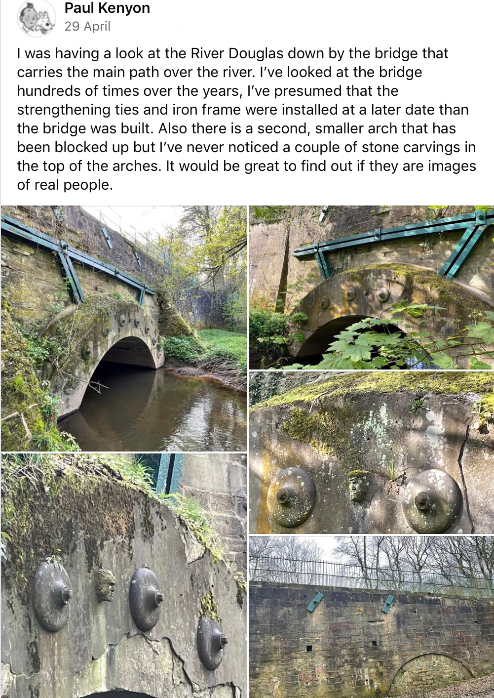
Local Bridges

I’ve noticed the names inscribed on some old bridge walls recently, and am wondering what does C.C. stand for?
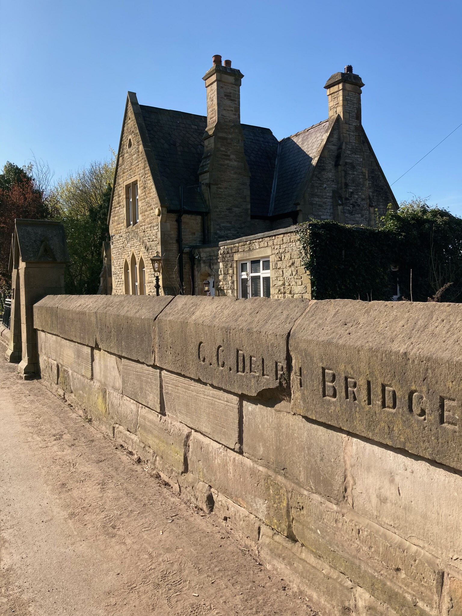
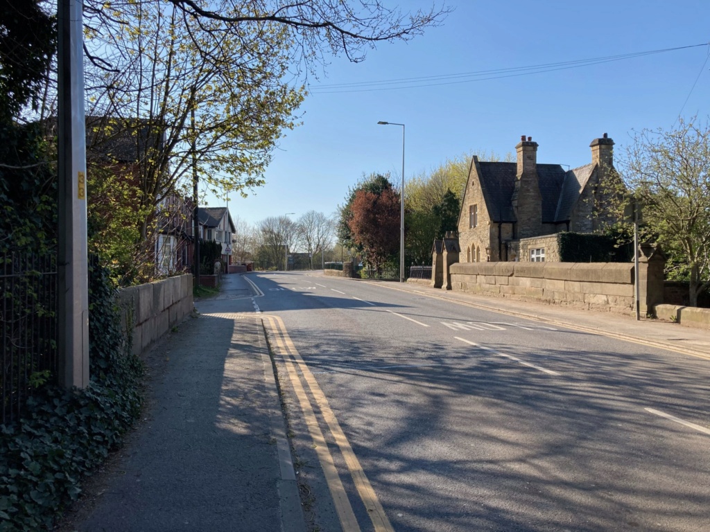
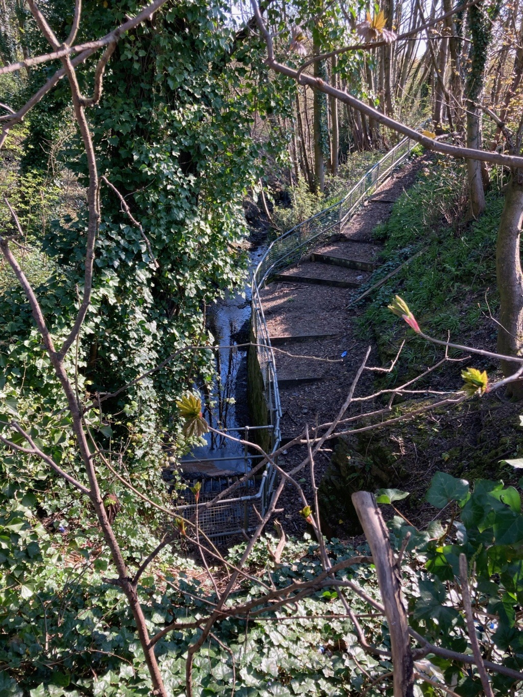
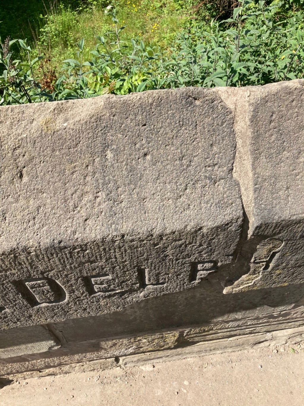
C.C. Delph Bridge
Warrington Rd, Lower Ince
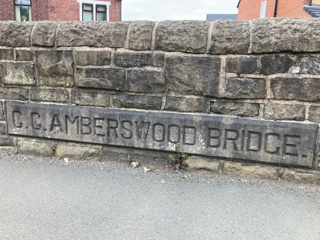
C.C. Amberswood Bridge
Manchester Rd, Higher Ince
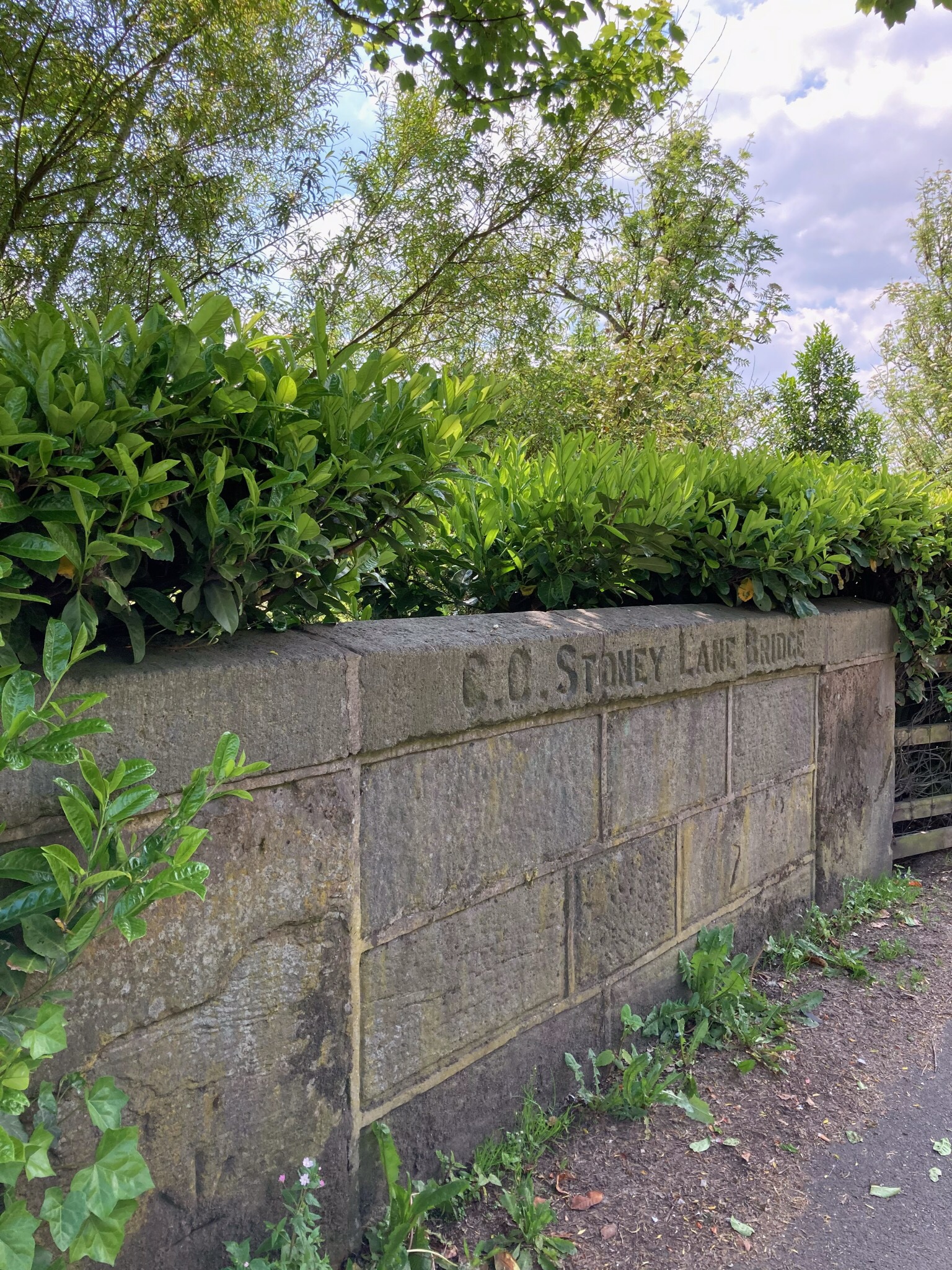
C.C. Stoney Lane Bridge
Liverpool Road, Hindley
Could C.C. be the County Council (of Lancashire)?
Started: 4th Jun 2021 at 20:14

Interesting jo anne... I recognised the first picture immediately although I never remember it as a bridge in the real sense. It overlooked the bottom playground of St. Mary,s junior school which was well below road level. Mainly a boys playground allowing them to kick a football or cricket ball about. Railway workers complete with the caps worn at that time, I assume from Springs Branch, would often stop to view the activity down there.
Replied: 5th Jun 2021 at 11:10
Rev Long mentions Delph Bridge when commenting about a photo of St Mary’s Vicarage (2004) - WW Album, Anne, and says “Ince Brook passes under Warrington Road here - and stays underground until it emerges near Westwood Flash.”
The brook is still above land on the other side of the bridge though.
Replied: 5th Jun 2021 at 11:32
Last edited by jo anne: 5th Jun 2021 at 11:33:08
Anne, I’ve been meaning to post these photos for a while - they’re of what was the bottom playground of St Mary’s Junior School.
Replied: 12th Jul 2021 at 20:46

You won't find any in Wigan!
Replied: 12th Jul 2021 at 20:48
Tell us more, Tonker! ![]()
Adam Bridge says “Built by Greater Manchester County Council 1983”
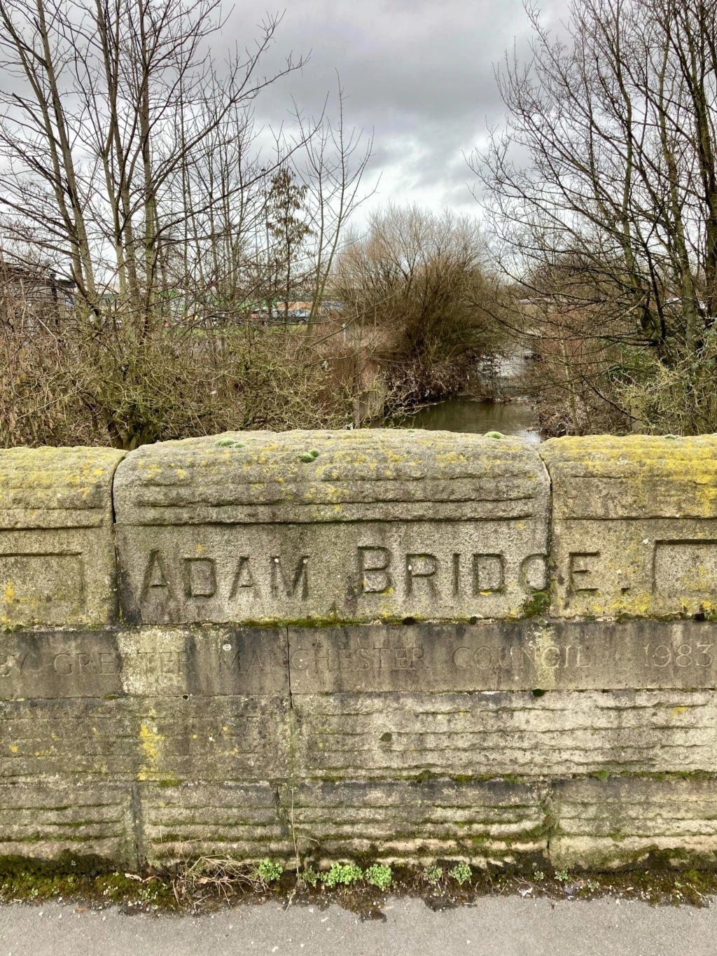
Greater Manchester County Council existed from 1973 (officially 1974) till 1986 - Wiki.
Replied: 12th Jul 2021 at 21:38
Not that Adam Bridge! ![]() And, if it was that Adam Bridge, it's only half in Wigan!
And, if it was that Adam Bridge, it's only half in Wigan!
Replied: 12th Jul 2021 at 21:53
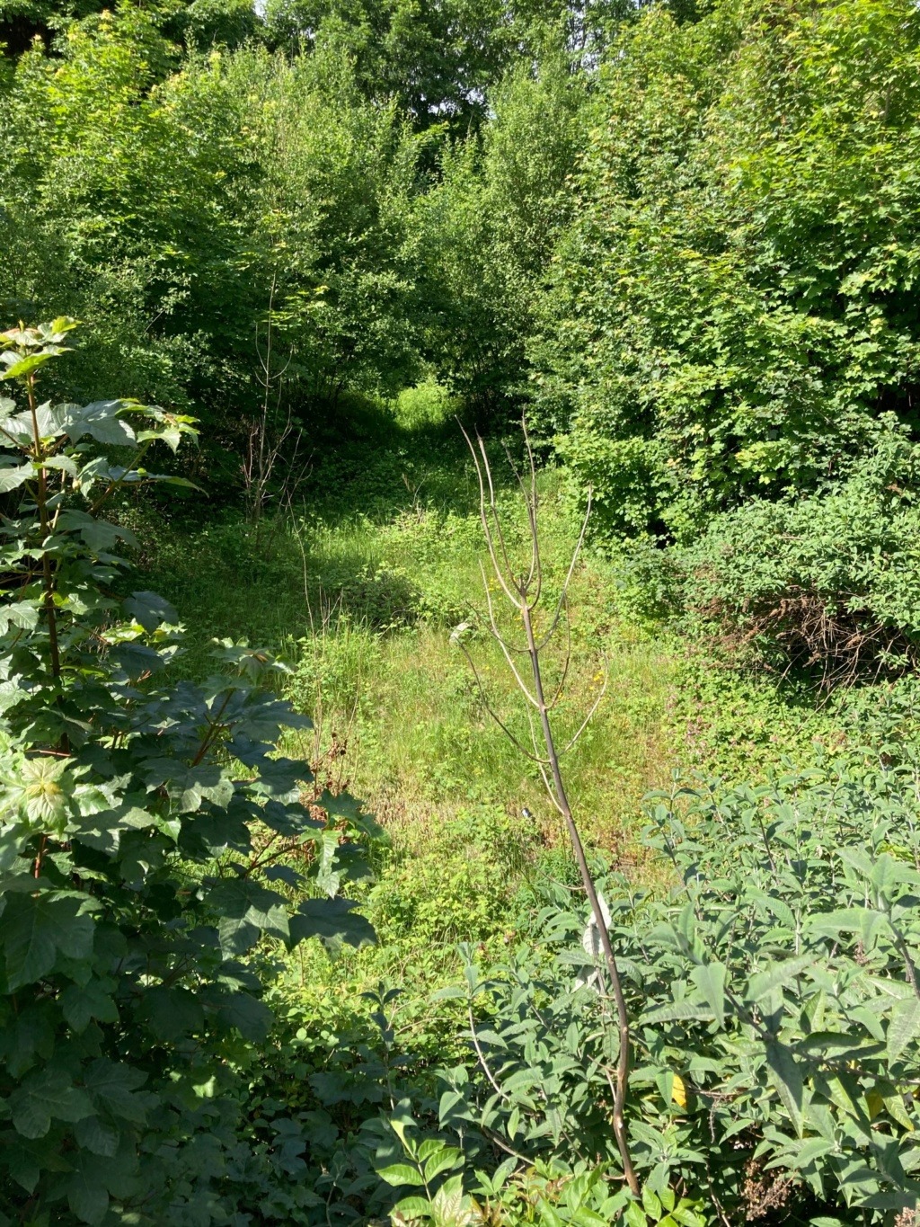
Thanks jo anne, I had managed to pick it out on google. I remember a brook running down the side of Donkey lane, maybe the same one.
Replied: 12th Jul 2021 at 21:55
It could well be, Anne. I love the name Donkey Lane, but can’t quite picture where it was. Aitch (23 May 2010) said: Donkey lane, stretched from warrington road, behind what is now Varty’s workshop, and is shown as a dotted line on the 1929 OS map beside delph bridge, and crossing the branch to top place line, then going towards the old GC line, around the back of Marlborough Avenue area.”
Tonker, please tell us what we would find on Wigan bridges rather than C.C., and why. ![]()
Replied: 12th Jul 2021 at 22:28
Probably Wigan Corporation. Wigan hasn't been administered by a 'county' for centuries.
Replied: 12th Jul 2021 at 23:33
Thanks Tonker, I’ll keep a lookout.
Replied: 12th Jul 2021 at 23:40
Thanks once again jo anne, Aitch's link most interesting. I could recall everything mentioned in great detail. Donkey lane was where the headmaster, Mr. Entwhistle (spl) of the junior school parked his car. Also a banner for walking day was always organised at the Warrington road entrance on account of the first few yards being paved with setts, the rest was nothing more than a rough track.
Replied: 13th Jul 2021 at 07:46
This is very interesting!
From Wigan LH&HS Public Group: Facebook (Apr ‘23)
Replied: 12th May 2023 at 10:32

Jo Anne said:
"Adam Bridge says “Built by Greater Manchester County Council 1983”"
I will explain how that bridge came to be built in 1983.
Up until those times the bridge was just a single carriageway in each direction, no wider than any other bridge of that type, and the Saddle bottleneck as it was called, was caused by three main roads, Warrington Road, Victoria Street (Billinge Road) and Ormskirk Road being funnelled into a single lane to go over the River Duggy, in the early 1970s a fourth road was added to the mix, in the shape of a direct route from the Cherry Gardens roundabout, to Newtown via a newly built bridge over the WCML joining the Spencer Roads and the extension of Scot Lane to Beech Hill Avenue, and the Construction of Robin Park Road from Scot Lane to the Saddle Junction, the original intention would have to been to join with the Wigan Northern M6 Link Road to the motorway at Standish,
but Woodhouse Drive was the only bit of that road to be built.
So in the mid to late 1970s, it was still thought that the Wigan Wallgate to Liverpool Exchange line, as it was known in those days, would be closed and the Seven Stars and the Skew Bridge, bridges would be demolished, as they carried the same Wigan Wallgate to Liverpool Exchange line over them, and after demolition of those bridges, that would have enabled the dual carriageway from Goose Green to be extended up to Wallgate and Pottrey Road, thus having a dual carriageway from the M6 into Wigan Town Centre, that being the Wigan Southern M6 Link Road.
But the bridge over the River Douglas would have to be widened to take the dual carriageway through to Wallgate, joining at the canal bridge and Pottrey Road at the same location.
So to please Tonker, I can tell you that the bridge was not built in 1983, two thirds or thereabouts of that bridge was built in 1983, because whilst they built the new bridge, they kept the road open using the old bridge, and they just joined the new part of the bridge to the old part, but the edges of the bridges and the parapet walls, were offset, the parapet wall on the old side pointed towards the railway bridge as it had always done so, but the parapet wall on the new bridge side actually pointed at an angle, and it still does towards the railway embankment, it lining up with the straight section of Pottrey Road, which is where the section of dual carriageway from Pottrey Road, would have run through from, joining up with the new part of the bridge, but the railway line did not close, and to bring the dual carriage way from Goose Green into Wigan, it would have required two new much wider bridges to be built at Skew Bridge and at the Seven Stars, and to give some idea of how wide those bridges would have had to be, then look at the width of the Spencer Road railway bridge, that was built as a dual carriageway over the WCML although the second lane as now been converted into a cycle lane, but it would have consisted of two pavements, four carriageways and a central reservation, just like the Spencer Road bridge, and you would have been looking at something not much different in size, to the bridge over Chapel Lane, very expensive and it would have been down to Wigan Council to provide or find the funding for those bridges, hence they never got built.
The road orientation over the bridge was altered when the Gyratory was built in 1999 and it was again altered when Southgate was built in 2013 ![]()
I bet Tonker reading this is getting annoyed 
Replied: 12th May 2023 at 11:59
Last edited by Tommy Two Stroke: 12th May 2023 at 12:00:08