Wigan Album
Wigan Parish Map c 1900
5 Comments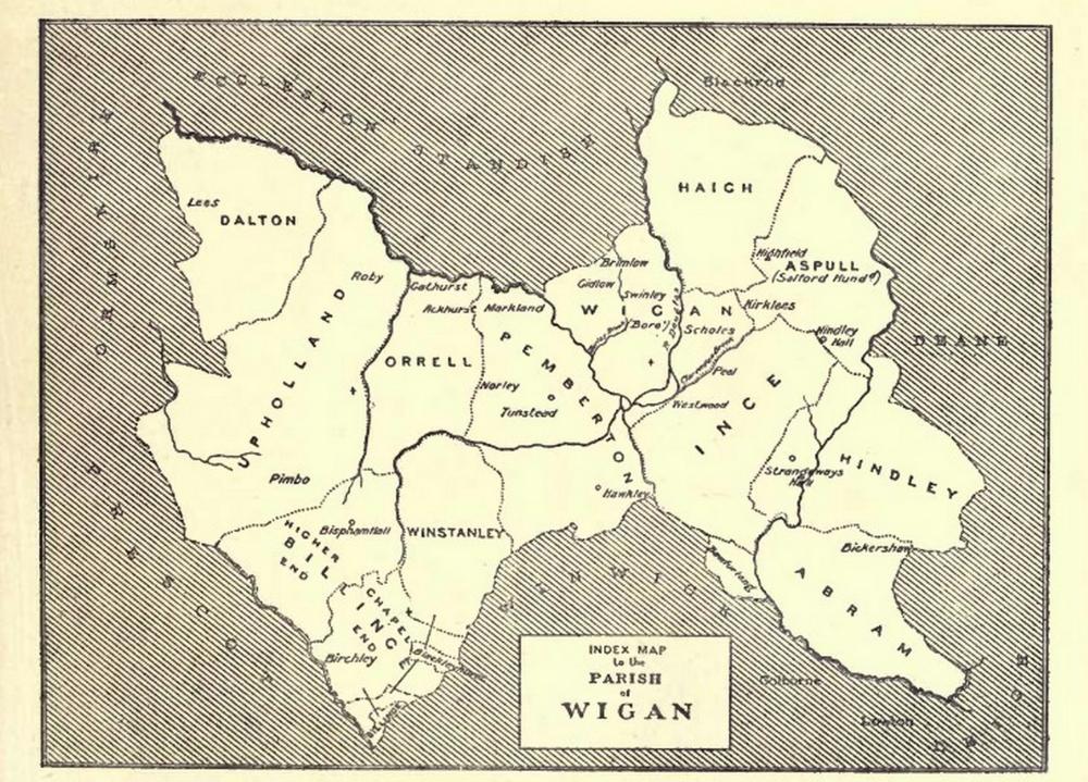
Photo: RON HUNT
Item #: 35423
Ron, what is the word over to the right in the shaded part near to Hindley and Aspull, please? It looks like "DMANE". Would that be an incorrect spelling of "demesne" which is where we get "Mesnes" from, as in Mesnes Street and Worsley Mesnes ? ( demesne being a piece of land attached to a manor house).
DEANE - a suburban area of Bolton.
Thankyou John.....the second letter looked like an "M" but I've since studied it closely and it IS an "E". It just isn't very clear at first glance. Many thanks.
I think this map is of the ecclesiastical ancient parish of Wigan rather than local government.
Correct John as there's no Parbold here.
"Wigan Rural District was an administrative district in Lancashire, England from 1894 to 1974. The rural district comprised an area to the north, but did not include the town of Wigan.
The district was created by the Local Government Act 1894 as the successor to the Wigan Rural Sanitary District.[1] It consisted of six civil parishes: Dalton, Haigh, Parbold, Shevington, Worthington and Wrightington. The contiguous parishes of Haigh and Worthington were separated from the rest of the district by Standish with Langtree Urban District.[2]
The rural district was abolished by the Local Government Act 1972 in 1974."
1974, the day local government and civic pride died a death.