Wigan Album
Hindley
10 Comments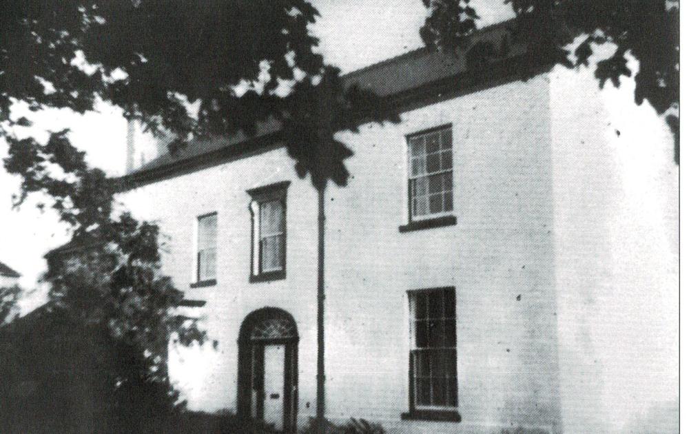
Photo: RON HUNT
Item #: 35042
I have always known it as the White House.
They had lived in a few homes and then from Walthew House the family moved to here, where they trained race horses.
See page 3 in the George Formby newsletter:
https://www.georgeformby.co.uk/nw_newsletter/archive2_htm_files/017.pdf
Cyril Wish I had a set of those Newsletters They are a MINE of information..
" and then to Wartbew
House Farm, which bas long since been demolished and is now the Heinz factory site."
Wrong.
Ron, the whole of the PDF archive of George Formby Society North West Newsletters, from 1995 to 2005 are here in the link, if you want a good browse: https://www.georgeformby.co.uk/nw_newsletter/archive1.htm
Scotch egg, you aren't any better with your spelling of it as Wartbew !
Besides the entire area from Scot Lane to Spring Road is now covered with concrete and asphalt, with the Heinz warehouse and other units covering the area where the house, farm and other buildings used to be.
Folks have searched for the site of the house and farm with overlaid maps, but was inconclusive. Maybe they should have gone by bike.
" the entire area from Scot Lane to Spring Road is now covered with concrete and asphalt, with the Heinz warehouse and other units covering the area where the house, farm and other buildings used to be."
You're way off the mark, Cyril.
The site of Walthew House and Farm is not "now covered with concrete and asphalt" and it's nowhere near the Heinz site.
The site of Walthew House and Farm house has been left, more or less, untouched. It's the wooded area on Scot Lane side of the tool hire shop on Walthew House Lane. On the Fourmarts Road side of the tool hire shop is the site of the old Orrell Colliery. Keep going, you've still not got to Heinz's.
The George Formby Society don't know what day it is.
The small area of trees on that road is what is left of a much larger area which was known as Kings Wood, and is or was owned by the Brown family. Those buildings of Philbin's farm, Walthew House Cottage and Walthew House were lower down and around the corner from there.
I've been told a local group went around this area looking for evidence of buildings and a couple of bricks were found. Though the old Walthew House Lane was made entirely of laid on edge bricks, and this ran for around a quarter of a mile up to the brickworks, and where thousands upon thousands of bricks must have been made over the years, so it comes as no surprise that bricks could be found around that area.
Heinz did own a good part of the land around there and not just where the factory is, it went right down to where the old mineral lines could be seen, which at one time would take coal down to the River Douglas navigation. The massive warehouse that belongs to Heinz goes a good way down there too.
Cyril, if you copy and paste the link below, you'll see where Walthew House was. That "small area of trees" is approximately one hectare and is the site of Walthew House Cottage and Walthew House.
https://maps.nls.uk/geo/explore/side-by-side/#zoom=16.9&lat=53.55414&lon=-2.67139&layers=257&right=MapTilerSat
That link is quite accurate, as you will see if you check the location match of the main railway line and Martland Mill Lane.
I'm still not convinced, because behind Walthew House and Cottage was large pear orchards, and when we has kids would go scrumping old Joe Ainsworth would come out and chase us off, and lately when I've been past there the trees look to be Sycamore and Horse Chestnut, along with scrub such as Goat Willow and Elder. Anyway also behind there it sloped down into a deep valley and as I remember the whole area got to be flattened with bulldozers, and gone over with those massive landscaping machines until it was all more a less looking flat, even part of the clay quarry was filled in too, and with the whole area still looking flat,
Also if, as you say, the plan all along was to leave that area as it was, why then did contractors go to all the trouble of demolishing those houses and farm all built around the 17th century or possibly earlier, and which a few years later would have been graded as listed buildings with preservation orders put on them?
You know the answer to that, as does everyone else.
The fact of the matter is that the grid co-ordinates of the site of Walthew House are 53°33'15.0"N 2°40'18.0"W