Wigan Album
Whelley
13 Comments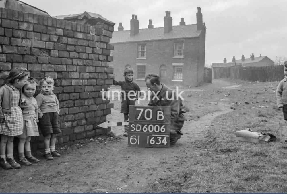
Photo: . Ozy .
Item #: 34975
All the caption says is Smith st .
Wherever Smith st. is , or more likely was , I don’t expect it still exists but this image remains one of my favourites to date nonetheless .
There is a Smith Street in Aspull but that doesn't mean to say there isn't/wasn't one in other areas of Wigan; there are Holt Streets, School Streets, Church Streets etc, in various districts. What a fantastic photo of those little children. Even at that young age, little girls always wore dresses or skirts....you rarely saw them in trousers, or even in shorts in the Summer, and even girls with short hair tended to have a ribbon in it.
It was a good idea of Time Pix to get children and adults in the photos. I think it was done purposely to counteract drabness and the soulless in many cases.
A wealth of information in these photos with people in them. The way people dressed etc. the Baby Boomer generation of children who are the elders now.
It would be lovely if any of these children recognised themselves...I just love seeing these old photos.
Cute photo of the children. X
Days gone by, love that photo. The wall doesn’t look too safe.
I’ve just discovered a site called UK grid reference finder .
If you type in a six figure grid reference , in this particular instance
SD607 ( eastings ) plus 060 ( northings ).
I.e. SD607060 it will take you to a location at the very top of Belle Green lane and on to what appears to be derelict land just south of Kirklees lane . ( which Timepix spells as Kirklees incidentally )
If you’re a bit thick like wot I am , don’t worry , just give it a go and you’ll soon get the hang of it .
N.B. This information isn’t for the benefit of qualified cartographers .
Ozy, thanks for the information. Smith street is shown on this old OS map:
https://maps.nls.uk/geo/explore/#zoom=18.7&lat=53.54923&lon=-2.59358&layers=168&b=1&o=100
Ozy. The grid reference SD6006 in the photo is located at Edinburgh Close, Ince WN2 2JQ. The four figure grid references are not as accurate as the six figure ones. However, it probably confirms the photo location as Ince.
Thanks for the link to the National Liibrary of Scotland site John .
This excellent map would have proved useful in resolving a dilemma regarding the location of a coal tippler on another Timepix image recently .
I also note that the supposed site of Coccium is marked on this map as being located near the northern end of Half Acre lane in Blackrod …. … Interesting that .
So thanks again John .
Smith St was at the top of Belle Green Lane the first houses in the background are in Tank St the houses in the far background are in Lisbon St
Thanks to you Ozy for posting all these wonderful photos. I find that 25 inch to the mile map invaluable for seeing where old streets etc. used to be. The best feature I find is the ability to slide the bar (at the bottom left of the screen) gradually from the old map to a present-day one so you can see exactly where an old building stood.
"Cain Edward", are you one of the Cain family who had the pie shop at the bottom of Belle Green Lane if you don't mind my asking?
Just tried that John , and you’re right , it’s a brilliant feature and it’s confirmed my suspicion that pretty much most of that area from the top of Belle Green lane up as far as Withington lane is mostly derelict . Cheers.