Wigan Album
Crooke
4 Comments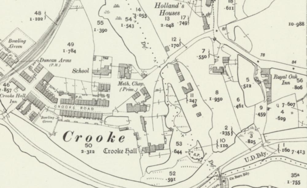
Photo: Rev David Long
Item #: 34880
Crooke hall stood right in what is now the centre of the marina, in the area that is currently the car park
There are quite a few photos and drawings of Crooke Hall on the Album, here's one photo from those of the hall in different stages of decay: https://www.wiganworld.co.uk/album/photo.php?opt=5&id=33877&gallery=Crooke&page=1
The first church and school also sank into what was an arm of the canal that ran down from the coal pits and into Crooke:
https://www.wiganworld.co.uk/album/photo.php?opt=5&id=1049&gallery=Crooke&page=1
Thanks Rev Long, good to know the precise location of Crooke Hall.
The Royal Oak is still there but I think converted into flats with bungalows on the car park.
I am thinking that the Duncan Arms along side what I think was a mineral line for coal waggons to the canal is now long gone?
colin;coal tippler just of the map near crooke hall inn; mineral line ran over wigan lower rd to john pit & standish hall drift.