Wigan Album
Whelley
6 Comments
Photo: RON HUNT
Item #: 34842
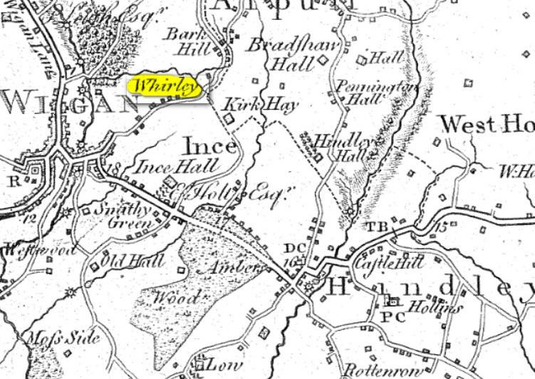
People tended to write names as they heard them back then! And in people's own handwriting rather than typed letters, so I imagine a lot of named got changed along the way! And a lot of the "s's" were f's as in "Weftwood" just to the left of "Old Hall" towards the bottom left of the map.
Ron, could it be that after the Battle of Waterloo it was renamed after the Duke of Whelleyton?
I notice Scholes isn't mentioned. I can see it’s there though. Yet West Houghton is ….perhaps there wasn’t many buildings at that time in Scholes.
Ron. another map , 1828 says Whalley so getting nearer.
Veronica, looking at a map of 1828 which Peter mentions Scholes looks as populated perhaps more so than Wigan, the only route to it was via Millgate as Powell Street and Greenough Street had yet to be invented.
Its also a long time since I heard that part of Ince referred to as Smithy Green. It must have passed out of common usage like Dumbarton Green at the bottom of Beech Hill Lane.
I wonder if Bark Hill further up than 'Whirley' is where The Colliers Arms is?