Wigan Album
Standish
14 Comments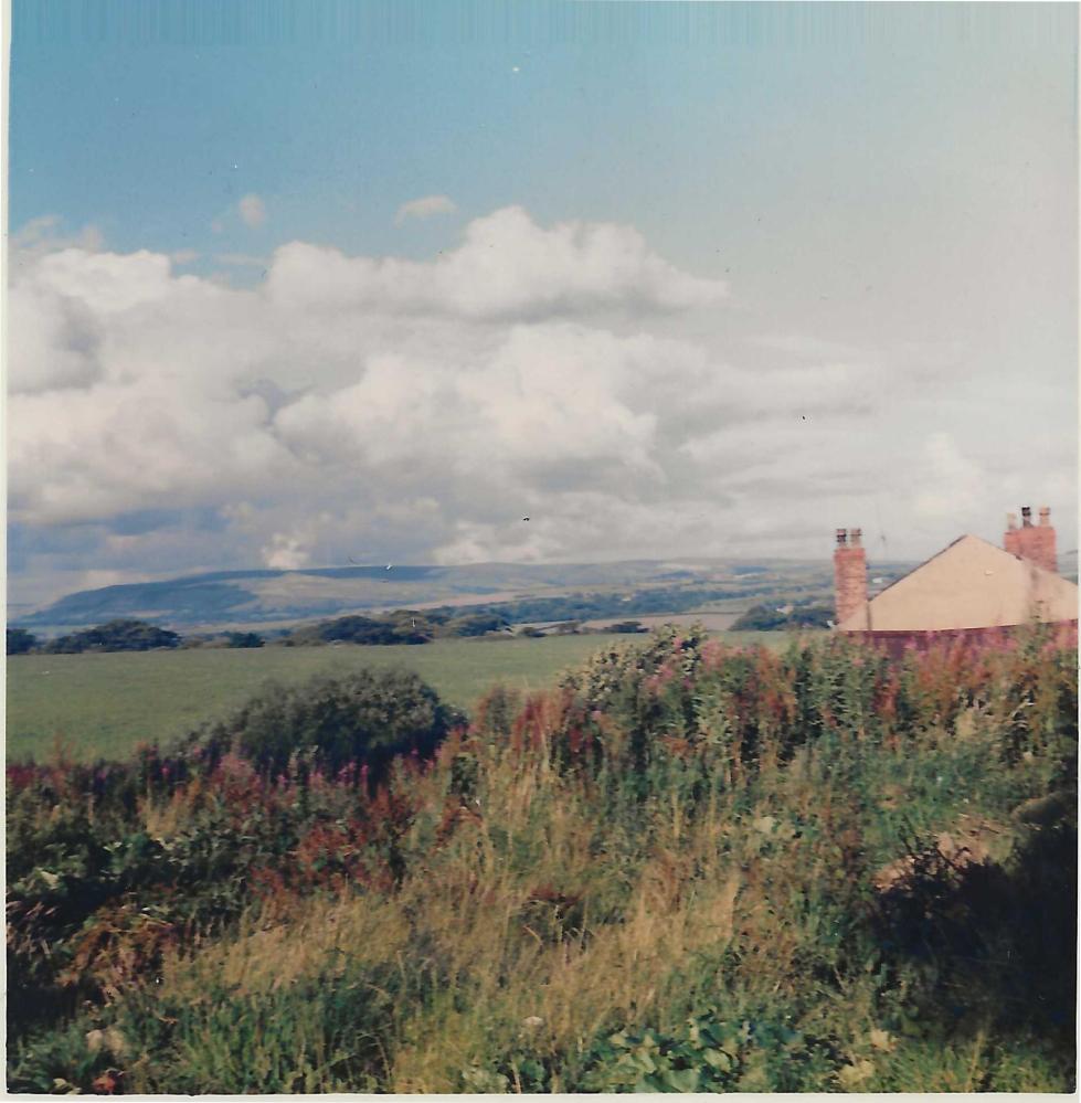
Photo: Barrie.
Item #: 34793
I hope the scene hasn't changed to much.
Does anyone know of a Hunters Hill in the Wigan area ?
I have a photo of my Dad, sister & myself & on the back is written Hunters Hill.
Yes I know about Hunters Hill Helen.
Helen , Hunters Hill is in the Parbold area. Not far from High Moor
Helen, I uploaded a photo of Hunters Hill under Wrightington (Places) a few months ago. Search for #34482. It was taken by my Father in the late 1920's. In the 50's & 60's I used to walk up there from Standish and back via Parbold.
Helen, quite a while since I last went Hunters Hill but, probably the mid 1980's, it's not far from Harrock Hall, Bispham Green and Mawdesley.
From the top there is a lovely view over the flat lands towards Preston and the Fylde coast. On a clear day you can see all the way to Blackpool Tower, Pendle Hill and the hills of the Lake District beyond.
At the top there are the ruins of an old Windmill that you can walk inside. If you Google Harrock Hall Windmill you will see a good selection of images.
I must get up there again come spring!
Yet again I fear we deviated from Barrie's subject matter of Grove Lane which is of course in Standish.
I think most of that land is now built upon but there are still some incredible views from that location.
Thank you everybody for the information re Hunters Hill. I have a vague idea that I may have uploaded the photo some time ago on WW, People, Bradshaw Family
Can't see the television transmitter, is is a high as the Eiffel Tower,1000 feet high, sure it was built about 1965-67.
Mr X. If you enlarge the photograph there is a white vertical line almost behind the Pike. This will be the mast. You can see the lights today from above Glossop.
A great photo Barrie. I have a soft spot for Grove Lane having lived there for 30 years. Colin, most of that land has now indeed been developed, so much so, Grove Lane no longer ends at the back of what was Birkett's shop, it now ends up the hill at what was once the Mill Pond.
I think Grove Lane now links up with those new housing estates built down rectory lane.
Does anyone remember the plane crash on Winter Hill not far from the mast? I think it was the early 1960’s.
I put this photo up to generate a wider discussion over councils etc and planning applications to build on green spaces willy nilly. No matter where you go as you get older, views like this are being blotted out by housing developments. Youngsters living on these estates have not the joy as we kids growing in the 1950's/60's playing out & roaming the fields & woods around Standish & district.
Incidentally, on Fathers original photo in the album Winter Hill mast is clearly shown. When he 1st came to Wigan in 1926, he became enthralled with the surrounding countryside out side the town walking or taking the tramcar to Standish and a back to his digs via a walk to Red Rock and the canal to Haigh and back through the Plantations onto Wigan Lane. I guess that is why I have found a number of photo's taken of this view from the Standish area over the years he lived in the village.
Barrie/Colin, quite a few years ago before the diggers moved in I had a ride over to the Millpond on the mountain bike and did a 360 panoramic, Grove Lane, St Wifrids Church and School, Rectory Lane, The Owls, Railway line, the estate where Vic Pit once was, Ashfield and Cranleigh, former Midgy Lane. I did the same shoot a few years later. The difference is unbelievable