Wigan Album
MESNES ROAD
8 Comments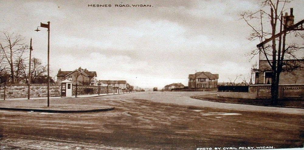
Photo: RON HUNT
Item #: 30024
Where do you keep finding these old photo Ron ? The one with the bandstand looks as if Mesnes Park was being formed.
Hasn't changed very much apart from the roundabout that isn't a roundabout, quite a lot of the Cherry trees that were along Mesnes Road have long gone, the telephone box albeit replaced by a new one was hit by a car and demolished some years ago, it was never replaced.
Between Mesnes Rd and Spencer Rd there used to be a reasonably large mound. It's now gone ,probably to make it clearer to see cars. I don't think it is in the photograph and therefore hadn't been constructed. Does anyone know it's history ?
There's a picture of Mesnes Rd looking towards the Cherries circa 1972 and the phone box isn't on the picture. I don't remember a phone box there. What year approx did it meet it's demise ?
Having looked again the telephone box on the photo seems to be a Police telephone Box, the telephone box I recall was actually positioned a little further down Mesnes Road, it was initially a red box WN1 Standisher, then replaced with a newer one, the type with brushed aluminium or was it steel, I can't recall the exact year (probably around 2000 - 2001 or thereabouts) when the car flattened it, luckily no one was using it at the time.
WN1 Standisher, the payphone in this picture is the old partially made of concrete early 1930s style, probably from the time when the road was first driven through from Walkden Ave. There was a traditional style red telephone box roughly in the same position until relatively recently which I don't think was ever replaced by the latest style of box. Don't know when that was removed.
According to my Father's 1926 diary, (he arrived in Wigan in March 1926), he called this a) the new Standish road or just "the new road". This got me looking at the old Wigan maps for the early 1920's and found that it was fields & footpaths from Kenyon Road. According to an extract from "The Industrial Railways of the Wigan Coalfield pt2" that I have, there is mentioned that, in 1923, Wigan Corporation planned to build a new road which became Walkden Avenue to link in with Buckley Street & Gidlow Lane using the existing bridge under the main rail line. I am assuming that Mesnes Road from Kenyon Road to Wigan Lane Marylebone was constructed during this time and was opened at the time Father walked it on June 27 1926. Interesting to note that the last house number in 1926 was No.44 (near the Brocket now) and by 1929/30 the last house number was 129 which is shown on this photograph.
Think I commented on previous posting that I had great aunt who in the 1950’s lived behind the Brocket before it was built. She always referred to this as New Road, never Mesnes Road.
It does look very rural before all the houses were built.