Wigan Album
Billinge
22 Comments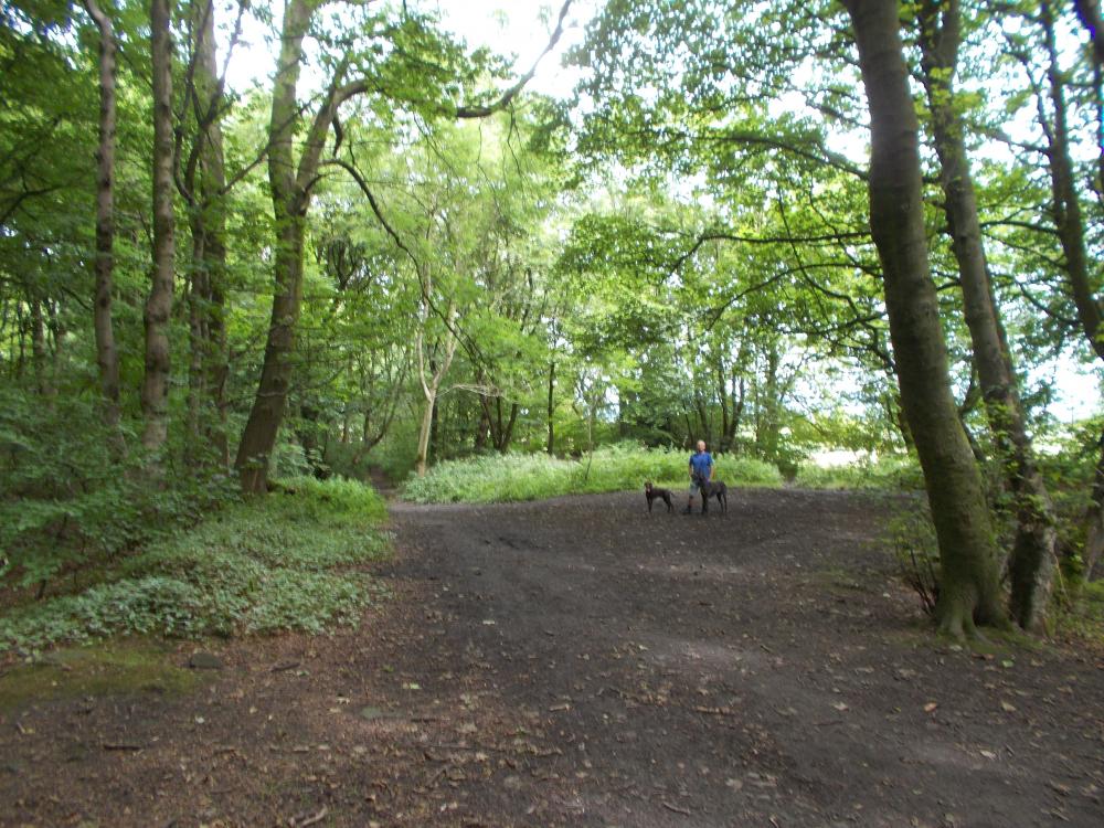
Photo: Philip Gormley.
Item #: 29540
Would I be right in thinking that Bobby's Lane leads into Cob Moor Road?
Helen - I'm afraid that I can't help you with your query. Have you considered putting 'Item 29309' into the searchbox? It will give you the opportunity of comparing both photos with each other. Regards.
Philip, I just tried that, but not much wiser. When I was a child we used to walk to the 'lump' on Sunday evenings. Often we would take a path from Crank Road, to the left, then right, into the wood, and up to the Hill. If we continued on the path, it veered to the left, there was a detached property on the bend I think. The path then joined up with Cob Moor Road. There were some police houses there, and I wondered if that was how it got the name Bobby's Lane. I never heard it called that.
That would be in the '50's
Helen - You don't appear to be having much luck when comparing the two photos, more's the pity. You do recall a detached property that had been situated on a left-hand bend, though, and it's quite likely the property was the now demolished pumping-station that can be seen on the left of Ron's photo. The four large trees on the left of my photo now occupy that particular spot; the bend at bottom-left. Perhaps others could also help in making further comparisons between the two photos, and also give further insight into how the pathway became known as 'Bobby's Lane'. Best regards.
Philip, To be honest, my memory is somewhat hazy. I moved from Billinge in 1962, and there have been a lot of changes since then. There used to be a wood off Crank Road, known as Coppice Wood. The entrance was roughly where Coleridge Road is now.
The building I was referring to was in fact a detached house at the edge of Billinge Hill wood.
By the way, I saw a photo you had posted on Upholland Secondary School page. A couple of my fellow pupils from St James' are on it, John Duckworth and Frank Baybutt. Any idea where they are these days?
Helen - Coppice Wood still flourishes, but is situated North of Billinge Hill Wood/Plants and, as such, is unlikely to appear on either of the two photos. There's some film of Coppice Wood on YouTube, so perhaps you might like to look that up as well ... just enter 'Coppice Wood Billinge'. The detached property is now a mystery to me, but hope that you will accept my apology for assuming that it was the old pumping-station. John and Frank? I haven't seen either of them for quite some time, nor have I been told anything of them, but I'll see what I can do. I haven't forgotten your earlier posts that supported the photos of the Bispham Cricket X1. Continued best regards.
Philip, Thanks for the heads up to YouTube, I have been trolling through some of the videos.
I need to have a ride over to Billinge, and walk up to the Beacon. Best to pick a fine day methinks.
It would be good to find out how John is doing, and his twin, Sandra. Most of my class at St James' CP went on to USM, and it was a big class, about 50 of us if I remember right.
Thanks for your help, and best regards,
Helen
Helen - Should you decide to attack Billinge Hill via Crank Road again, then your best bet would be to take the pathway that lies directly opposite Brownlow Farm. You'll soon meet old friends Coppice Wood (on your left) and Billinge Hill Plants (on your right), before heading off towards the summit. You really must get yourself going with something like Google Maps - it's quite gob-smacking and will help you to find the various pathways that you and your friends once took (a tear or two allowed). Take care.
Bobby's Lane ran parallel to Cob Moor Rd but was closer to Longshaw and did go past the pumping station and then through the wood to the hill. The houses on the left of Cobmoor Road were used by people working at the radio station. I remember Harry Petrie and Martin Green lived there. The council houses were built in the mid 50's. After the houses there was a stone cottage and higher up next to the big wood another house. You can still get into the remains of Coppice Wood from Crank Road.
Bill - A great bit of info, thanks. It's been my intention to get a copy of an old map of Billinge for quite some time, and a copy would help me to identify the 'stone cottage' that you mention and the 'detached house' mentioned by Helen; in addition to previous other points of interest. Regards.
Philip, There's a website www.old-maps.co.uk that lets you look at old O.S. maps and once you get the hang of it is pretty good. Just looked at the 1908 map on there and see two houses in that area up Cob Moor road. There is Cob Moor hall then just by the big wood a place called Hootons. Hope this is some help
Bill: Thanks for your encouragement, and also for pointing me in the direction of the old maps website; I'm confident there'll be other hidden gems on those of Billinge. Cob Moor 'Hall' and Hootons, by crikey ... shades of the period drama. Regards.
Cob Moor Hall, and Hootons: Found them Bill, found them! The game is afoot.
That's good to hear. Next time I come down to Billinge I'll have a good walk that way !
Hi Bill,
I was hoping that you might see this and put me on the right track. So I didn't imagine the 'detached house' at the edge of the wood? Hope you are keeping well, and your family also.
Hi Phil,
Thanks also for your comments. I must do as Bill says, and take a walk myself next time I am in the area. No excuse really, as I live much closer than he does!
Hi again,
I found the map. It would seem that my house could have been The Hootons. The name seems to ring a very distant bell with me. I spotted Brownlow Farm, home of the Abbotts, and Plane Tree Farm where the Middlehurst twins and their sister Anne lived, (we could climb up to the Beacon through their farmyard past the pig sties, I remember the aroma)!
Thanks again for the heads up, Bill, and your help Phil.
Best regards. Helen
Helen: I found Bill's lead to the old-maps website to have been of great help, the maps are also informative and easy to digest - you seemed to have homed-in quite easily on Hootons, eh? With further regards to your next assault on Billinge Hill, the once popular pathway that still passes through the yard of Beacon Farm (formerly Belvidere Farm) is rapidly becoming overgrown, while a slightly better option for you would be to address the said farmyard and then turn right; heading towards the rear of the Radio Station. The only other pathway that I can suggest is that which connects to Beacon Road. Here goes ... Park your car at the very end of Beacon Road and opposite the site of the now demolished vicarage, you'll then be faced with a ten minute walk along the fairly straight pathway that leads to your goal. How's that! The Middlehurst twins ... ah,yes, Norman and Philip. They and their sister lived at Belvidere Farm; Plane Tree Farm was, I'm reliably informed, the home of Louise Glover.
Hi Phil,
Sorry for mixing up my farms. It has been a long time!
Thanks for your info as regards walking up to the Beacon. I think I only used the Beacon Road route once. It was a fair trek from 'The Moss', especially for little legs like mine were then. There used to be another path, from the top of Shaley Brow, further on than the wireless station I think. This could join up with the route you mention. I may try Beacon Road, and combine it with a visit to my cousin, who lives at the top of Main Street.
Regards Helen
Helen: Go Beacon Road! The pathway that leads from it is, for the most part, 'gravelly' and free of 'slutch'. Regards.
Phil,
OK, will do, Beacon Road it is!
Hi Helen, Hope you are well . I also remember the pig styes you mentioned. I did the Beacon road walk to the hill a couple of years ago but much prefer the way we used to go through the wood from Brownlow. There used to be a couple of mine shafts in the wood and you can still see where one is capped over. So many happy hours playing in the woods as a child.