Wigan Album
Wigan Map circa 1850
13 Comments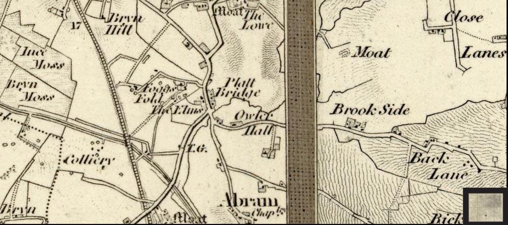
Photo: Ken
Item #: 23655
What do the initials TG stand for, shown a little below The Elms? Anyone know?
I think TG stands for Toll Gate.
Toll Gate ?
I think its Toll Gate Irene
TG toll gate I would think
TG means Toll Gate Irene
Thanks everyone.
Irene. I think ,without a doubt, we can now safely say, it means toll gate. I didn't know what it referred to.
You can see the ordnance survey abbreviations on this site.
http://www.ordnancesurvey.co.uk/oswebsite/aboutus/reports/misc/abbreviations.html
Many thanks Ken, you can always rely on WW readers for help.
There is a TOLL STREET in PLATT BRIDGE off LILLY LANE just after HOLY FAMILY PARISH HALL.
You're right, Joe. I know Toll Street well.....I just never connected it with a Toll Gate.
If you zoom in on the map you can see a line drawn across the road at the toll gate point.