Photos of Wigan
Photos of Wigan
Album Contents
Album Contents
Wigan Album
Wigan Map circa 1850
3 Comments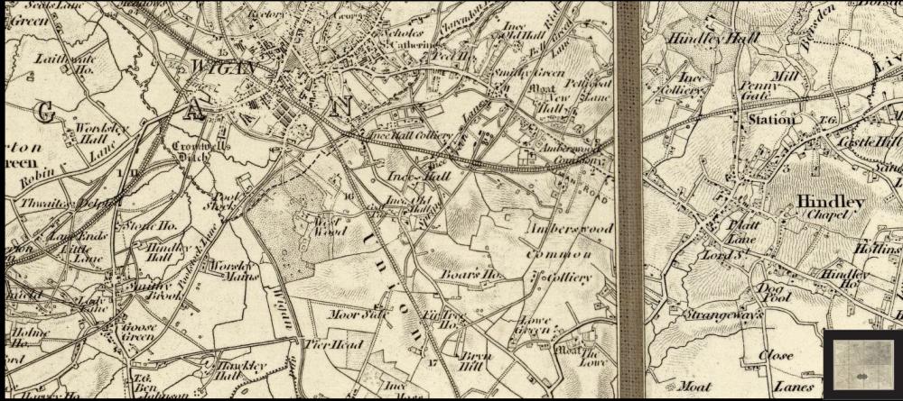
Wigan and some of the surrounding area 1850's.
Photo: Ken
Photo: Ken
Views: 4,114
Item #: 23653
Item #: 23653
A very small part of the David Rumsey Map Collection - showing Wigan and some of its surrounding area from approx. 1850’s.
Comment by: Stuart Naylor on 30th June 2013 at 18:57
That map is actually from 1847
Comment by: Ken on 30th June 2013 at 20:30
Hi Stuart, thank you for the information - all I can tell you is that there is a lot of info’ given with this map. It is in 4 parts, or “quads”, and the date given for this “quad” the SW which includes Wigan and its surroundings is 1858, the three other quads which make up this map of Lancashire are 1854 for NE Lancs, 1852 for NW Lancs quad and 1859 for the SE Lancs quad. The map was published in 1870 and the survey maps were published from 1805 to 1870 and frequently updated - these sheets, it says, range from 1848 to 1870.
Comment by: Wigwann on 30th June 2013 at 22:04
Very interesting, however do you have any of Platt Bridge?
Leave a comment?