Wigan Album
Beech Hill
3 Comments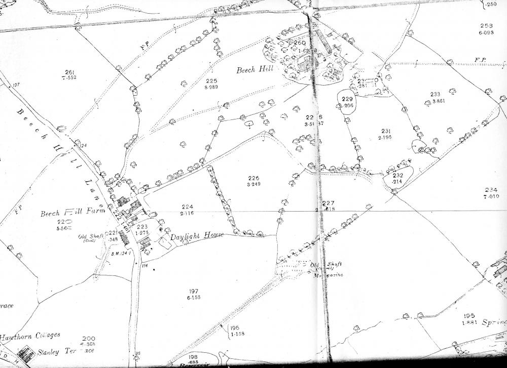
Photo: Andrew Lomax
Item #: 23324
The O/S site gives this map a date of 1894. It's different to the 1907 map I have.
If you go to
http://www.wiganworld.co.uk/album/photo.php?opt=5&id=11756&gallery=Beech+Hill&offset=20
you can see the 1849 map of similar area, "Daylight House" appears at the bottom, left hand side and the "structure" next to it is listed as "Higher Woodhouse" - don't know if this helps.
I make it 1894 as well.
Have you noticed the 2 "old shafts" on the map. They were, on the left Douglas No5 and the other is Dougas Bank No6.
No6 has got a tram road running down towards Woodhouse Lane.
No6 pit was (roughly) on the corner of Baytree Rd and Cranberry Ave, there used to be two semi's built on that corner, they had to pull them down because of subsidence.
Take a look on street view.