Wigan Album
Scholes
3 Comments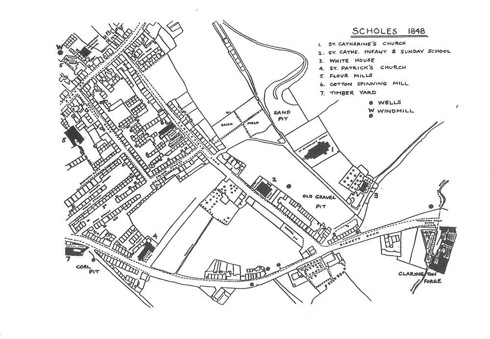
Photo: JohnAlan
Item #: 21173
Fascinating map - thanks for posting. Looks like there was a well at or close to where I lived in the 1950's, at the bottom of Birkett Bank. I remember being told about a gravel/sand quarry, nice to see it marked. When the old Crispin was pulled down I was told there were hardly any foundations, seems as if the church wasn't alone and I believe the plaque of St Catharine's School carried the date 1832, it was already 16 years old when this map was produced. There was also a Birkett pit close to the Forge but it isn't marked.
Interesting picture John. I was born in School St, Scholes.
I knew the area well but much later of course. Brought up in Golborne St and Scholefield Lane I went to school at St Cats and still go to St Catharine's Church. With mates I played all around the area, sand hole, clarry, over the fields (1, 2 and 3) Plants. Great days they were too. Didn't need to worry about staying out until dusk then. Everyone looked after each other.