Wigan Album
Hindley
13 Comments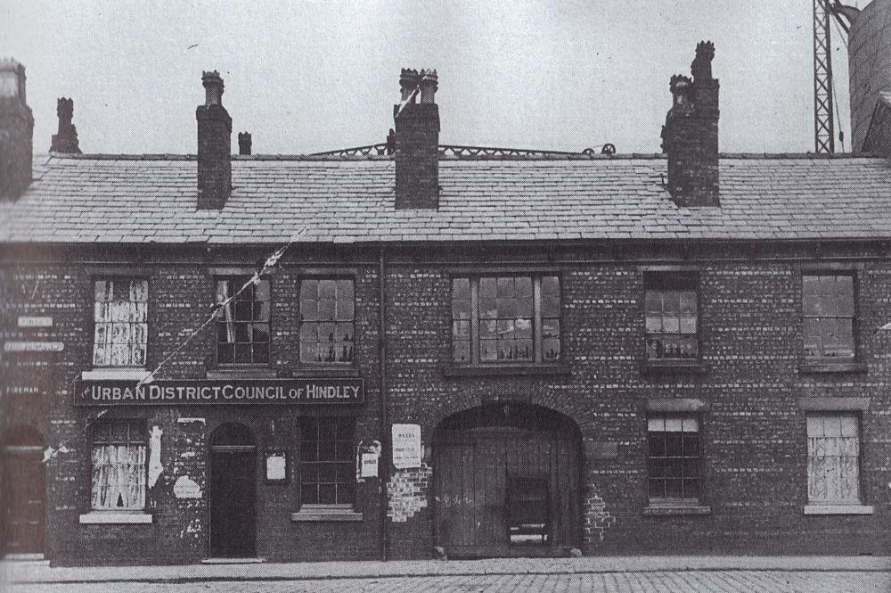
Photo: Dennis Miller
Item #: 11122
Does anyone know what street this was? There looks like a street sign on the far left, but I cant make it out.
Does that look like a pit wheel at the back? Maybe a clue as to the location if anyone has an interest in old mines too.
Was it not at the bottom of Cross Street opposite the Town Hall?...
Looks like a huge Gas containment Tank to me not a pit wheel.
According to the 1925 Hindley diretory, situated under"stuff", the Council Offices stood then where they stand today, but perhaps the photo is pre-1925. The Hindley directory shows names of all the streets AND the residents of 1925, and includes parts of Platt Bridge.....really interesting!
This building was in Cross Street.Showing behind it is the gas holder on Derby Lane
It was on Cross St,the Fire Station and Ambulance Station were close by,Fielden Factors is close to were the offices were.
I could have sworn I had included the capton in that scan.
It is indeed Cross Street, the terrace the offices are part of once joined with what is now The Wigganer, there was a gas works behind them. The photograph was taken from where the present council offices are.
Along with Irene's comment; Platt Bridge and Hindley Green, were considered small parts of Hindley and did not have seperate signs on their borders like they have today. E.T.
Well said ET... both Hindley and Abram had their own District Councils... and Platt Bridge was sorta shared between them, but with Hindley having the greater say. I can 'just' remember a time when if my Grandmother said she was off to town she meant Hindley, not Wigan. That may seem trivial, but it was the mindset of the Platt Bridgers at the time.
I often wonder, if the planners of the L&L Canal had actually gone ahead with the offshoot towards Hindley at Top Lock if history would have different. Because it was the L&L that contributed to money and investment coming to Wigan, whilst Hindley was left with no canal link?
Dennis/Eric---There used to be a marker in the footpath,
somewhere near to Moss Lane, which said---Hindley---Ince.
Used to have a Joke with my mrs "No such place as Platt Bridge"
Much of Platt Bridge, from Lily Lane (actually Hey Brook just south of it), back along the canal, to the WCML, and then along the Platt Bridge Junction line across to the Whelly Loop line, almost to Amberswood West Junction, and then back in a wiggly line to Walthew Lane, and then again in a wiggly line to Foggs Lane, was taken out of Ince UD, and the Parish of St Mary Ince, to form the Parish of St Nathaniel Platt Bridge in 1904. Until then 'Platt Bridge' was the area around the eponymous bridge on Warrington Road on the junction of the Hindley/ Ince/ Abram borders. I don't think any of Platt Bridge was in Abram.
David...
I can remember when the bridge near Lily Lane actually bore the name 'Platt Bridge' engraved deep into it capping stones. Also, I have to stop and think when I hear 'Hey Brook'... to most Platt Bridgers this was always the 'Cocky Brook'. I think the nickname had something to with glass, but don't take that as hard fact. But the term 'River Glass' is ringing in my brain.