Wigan Album
scholes
10 Comments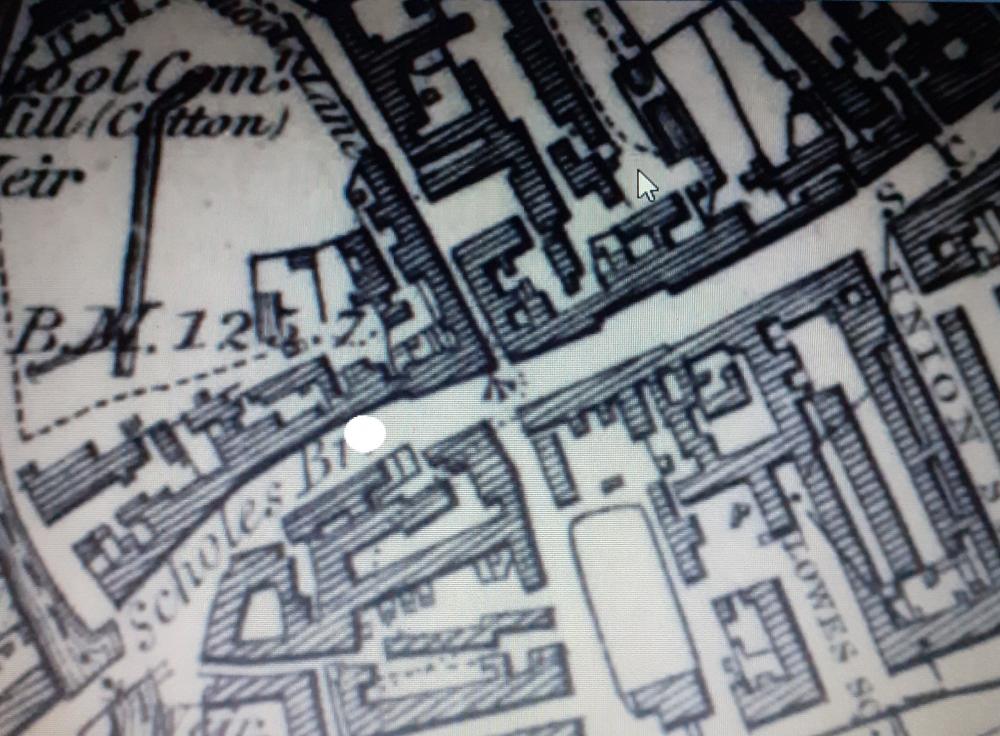
Photo: Peter Walsh
Item #: 33439
I remember that behind Scholes Picture House it was set high up on a hill. There was street further down from the Pictures near Millers? That street was high up as well and I can't think for the life of me the name of the street. I used to cut down there sometimes going up town. Although I don't recollect shops like those on the photo. It was mainly terraced housing.
Peter,If you mean the stretch between Scholes river bridge and Scholes crossing ,I think you are right given where Union St ,and Lowes square are on the map.
The street I mean was Morris St. Where the arrow is pointing would have been round about in that area. Lowes Square and Union St had entrances in Hardybutts and Scholes. The Picture House was a little higher up Scholes. Could that building have been built into the gap on the other photo?
Veronica, near to where you said you cut down, to go uptown.There was a Lime St. Hence Limefield flats.
Bill, I think the white spot is where the picture was taken, looking up the hill towards what became scholes crossing.
Veronica /Edna. I think you are thinking of Lower Morris Street next to Millers, which ran down to Lime Street. I went down and up this road every School day from 1963 to 1970, as I walked from Scholes to WGS. During that time I saw most of Scholes knocked down and the new buildings, including Limefield and the Ball and Boot etc go up.
Peter. Is this the section where the Shovel & Broom pub was?. If so, on the top corner was shop that sold books, on the opposite side from the Blue Bell pub.
That's the one lower Morris St- it was a steep hill.
Albert, I think the shovel and broom was down there. The Bluebell, Travellers Rest, Bold Arms, Shovel and Broom, Rope and Anchor going down the hill. I mentioned the Balcarres and Rose and Crown but I think they were up near Greenough Street where I used to live in 1951.
At the rear of Scholes picture house, where the arrow in photo is, was Woods yard where my mother and parents lived in the early 1900s. My Grandmother Florence Tymon played piano along to the silent films at the picture house. Although I have never seen Woods yard listed on any map I do have old mail addressed to Woods yard off Lime st and upper Morris street