Photos of Wigan
Photos of Wigan
Album Contents
Album Contents
Wigan Album
Marus Bridge
3 Comments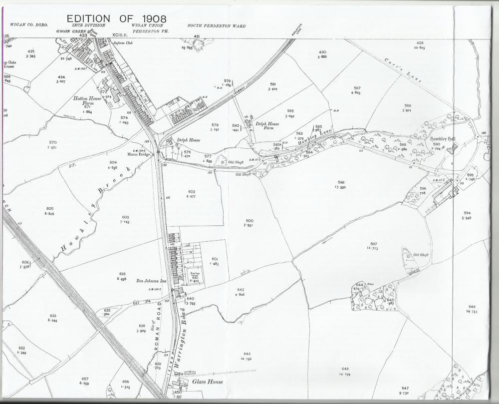
Map showing location of Delph House and Delph House Farm
Photo: Cathy Bolton
Photo: Cathy Bolton
Views: 4,219
Item #: 22485
Item #: 22485
This 1908 map shows the position of Delph House, long since demolished, I guess in the 1930s. The road marked TRAMWAY is Poolstock Lane, so Delph House, the one on a recent photo, was on the corner of Poolstock Lane and Warrington Road. Sadly Delph House Farm, which is also shown on the map, was also demolished two or three years ago and houses are now being built on the site. Delph House Farm was the one on the corner of Cranfield Road and Marus Avenue.
Comment by: Darren W Wadsworth on 20th January 2013 at 00:33
to Cathy,A great map,yes it shows delph house where my dad lived (Roland Wadsworth)and Delph House Farm where in later years my dads brother (Horace Wadsworth) lived.thank you for sharing the map.
Comment by: Catherine on 20th January 2013 at 04:08
Thanks for that Cathy. As I mentioned on the other post, Delph House farm was still standing, although it was falling to bits, at Easter last year. At least I know where Delph house was now.
Comment by: Karen Parkinson on 12th October 2020 at 22:17
Our Grandma, Olive Harrison was born at Delph Farm in June 2917.She was one of 13 children. Her mother and grandfather also lived at Delph Farm
Leave a comment?