Photos of Wigan
Photos of Wigan
Album Contents
Album Contents
Wigan Album
pemberton centre
3 Comments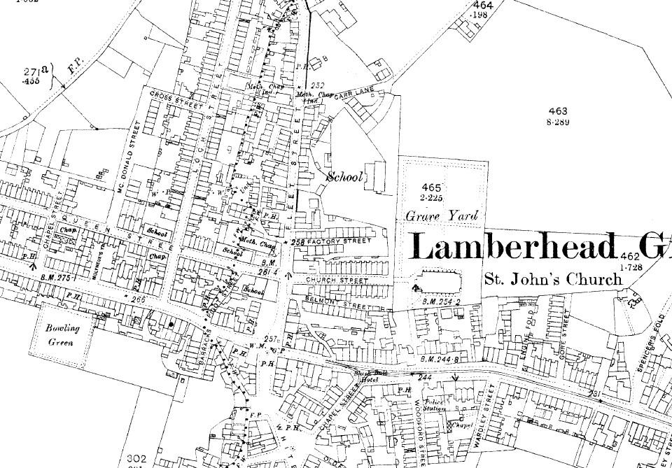
Pemberton Map (2)
Photo: Mick
Photo: Mick
Views: 3,691
Item #: 21461
Item #: 21461
Extract from map showing Fleet St area, circa 1890.
Comment by: tricia on 19th September 2012 at 21:12
Thanks again. You know , Mick I think it should be on here, maybe in the same area as McDonald St. It was definitely there in 1880's as I found them on the census living there there.
how interesting to see factory street is now called st john street ,wonder if there ever was a factory around there ,my grandparents and my mum and dad lived in st john street the houses stillthere
Comment by: Margaret on 24th October 2017 at 16:05
I lived on Orrell Road up to 1950. Our back yard looked over the Bowling Green. My grandma lived in Molyneux Yard where Grovenor House is noww
Leave a comment?