Wigan Album
Haigh
13 Comments
Photo: . Ozy .
Item #: 34914
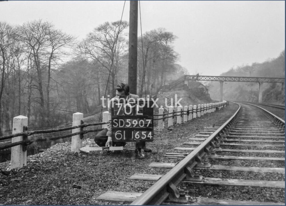
whelley loop line bridge over line past whelley station heading towards stanish
Whelley loop line....or if you like' The Lancashire Union Railway.
Is it really 'Haigh' or the old footbridge on the Whelley loop line near the Cannon Sharples school? - the abutments for the bridge are still in place
Whelley loop line before the bridge over the drive, the parapets and steps of the long demolished footbridge can still be made out if you know where to look.
Anyone know what it connected to , and from where ?
[ please note the answer “ one side o’t track to t’other “ cannot be accepted unfortunately ]
Did it connect to the St Helens to Blackburn line, from the St Helens to Blackburn line?
I meant the footbridge actually George .
Sorry , I should have been more specific .
There was a single track from the WCML and the other one burrowed under the WCML. When the two tracks came together they went towards Platt Bridge. The was also a link at De Trafford junction and to the Fir tree line to St Helens. There was also links to Adlington and Rose Bridge Junction and Amberswood Junction.
The Whelley loop line went from Standish to near Bamfurlong by-passing Wigan NW. It was mainly for freight trains. It had connections to the Wigan to Adlington line at Red Rock, to the Wigan to Hindley line at De Trafford Junction, the Wigan to Bickershaw line at Platt Bridge, the Wigan Central line at Amberswood and connected to the Wigan to St Helens line near Springs Branch. So it was a very useful connection.
Ozy , I dont think the path went to & from anywhere in particular really, just a general path through the plantations . If you look to the left of the surveyor you can see the continuation of the path which picks up the path at the side of the (formerly) Yellow Brook, - left to Whelley right to the drive. You can still trace the path to the former footbridge if a little overgrown… Also of interest plans are afoot to surface the former track bed from roughly this point through to Hall Lane….Watch this space!
Thanks for that Mr Wood .
I think the cutting beyond the footbridge is where the tunnel used to be before subsidence compelled the railway company to open it up .
And didn’t there used to be a platform , or a halt of some kind further along towards Hall lane that served the hall ?
All before my time but someone will doubtless know .
Regarding surfacing the track bed . I recall this being mooted back in the 80s and for a number of weeks , a tracked excavator was engaged in draining the area , but it was money wasted as it ultimately came to nowt. Typical really …
So as you say “ watch this space “.
Ozy,Yes you’re right about the tunnel, the landowner had demanded a tunnel through his land purely for aesthetic reasons, there being no real engineering need for it . He must’ve had some clout with the powers that be! Work began but the ground proved unsuitable and it kept collapsing so was abandoned in favour of a cutting. I imagine he insisted on the footbridge being built and it looks quite a substantial structure for the actual purpose! (More clout?) the Halt I think you refer to is perhaps the private waiting room on Red Rock station ? (More clout…?) re- the surfacing of the trackbed, I think this started in the 1990’s from the canal nr rabbit rocks and the must have run out by the time it reached this point! Work has actually re-started on the next stretch to Hall Ln, its already been surveyed , tree and undergrowth clearing ongoing and new signage has gone up, so fingers crossed……!
My guess would be railway lines no-longer with us.