Photos of Wigan
Photos of Wigan
Album Contents
Album Contents
Wigan Album
Highfield
2 Comments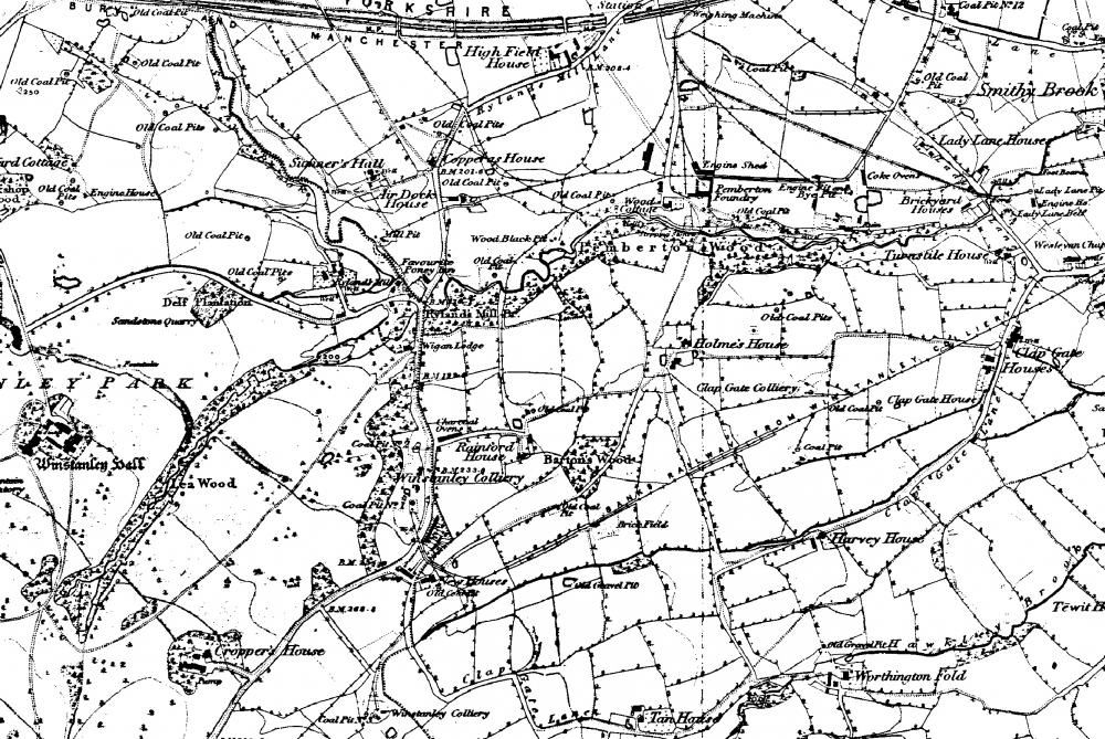
highfield map of 1842
Photo: fred foster
Photo: fred foster
Views: 2,425
Item #: 24761
Item #: 24761
this map shows Billinge Road from Pony Dick to be Rylands mill lane. It must have been renamed at some time later. This shows winstanley when it was all farm land
In the middle of the map can be seen Banks's railway. This ran along the estate wall, crossing the road at Pony Dick, and again crossing the road at Clap Gate Lane and the coal train finished up at Wigan Pier where the coal was tipped into barges
Comment by: Paul on 16th January 2018 at 13:50
On the right hand side of the map, you can also see Clapgate House, which is still there today. You can make out Pemberton Rd, going down Windy Arbour and through Pemberton too
Leave a comment?