Wigan Album
Platt Bridge
8 Comments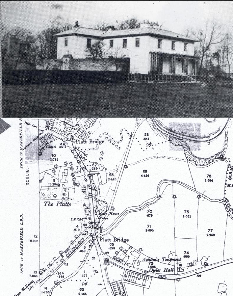
Photo: Dennis Miller
Item #: 21876
I now know it was where New Street and Car Street are today... near the site of the Late Shop, as you can see from the map, with Lily Lane to the south. The map was given to me by Pam and is dated 1893, by 1908 the house was gone and New Street and Car Street in existence.
Well done Dennis,I dont think anyone knew the proper location of this house,all most a bigger mystery than Elm St,wouldnt mind a copy of the map in question the earliest map I have is 1905,perhaps Pam would post the map on Wigan World,I feel sure a lot of people would find this to be of interest.
John, I have not done so yet, but within the next day or so I will be posting the map at...
http://www.ecadfael.fu8.com/os_maps/
Keep checking, you can download it from there then.
Just to be clear,I mean a posting of the map in more detail would give a greater insight into the geography of Platt B ridge over one hundred years ago when it was in its infancy I feel sure that it would of interest.
John.... yes. I will post the whole of the map. I may have to split it up into about 6 sections, but it will be large scale.
John... the maps I post are massive images with loads of detail. Your browser may be resizing them to fit the browser window... clicking on them should show them at full size. I am talking about the full maps now, not the thumbnails on the index page.
Dennis - I have sent you an email re maps to the left and right and below of yours
Thanks Paul... I have it, worked fine. I will be in touch.
I don't have a copy of the map anymore. I gave the map to Dennis because I knew he would make better use of it than me. Dennis can clean the map up etc and he understands it better than I do. I got the map when sorting through my dads stuff and I have no idea where he got it from.