Wigan Album
Mining
12 Comments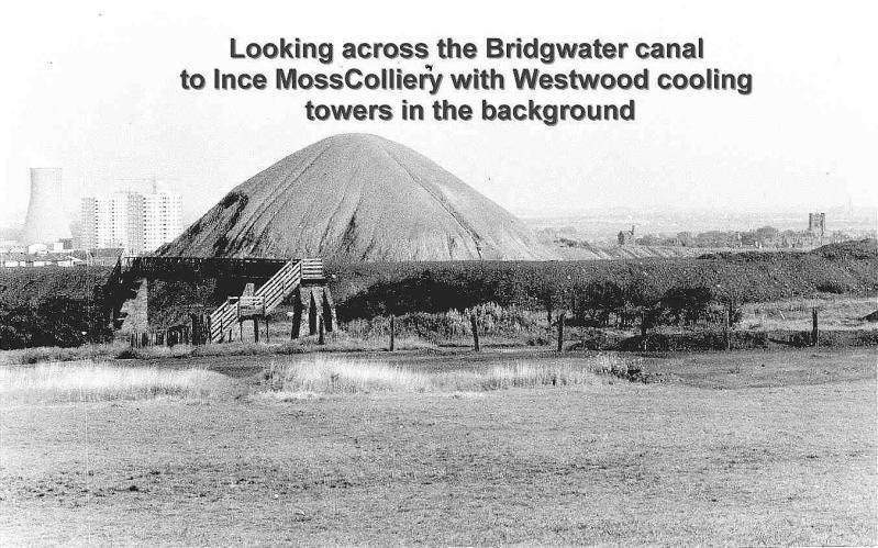
Photo: Barry Latham
Item #: 616
The picture doesnot seem to be their. You wouldnot see flats and houses near the cooling towers and horses had too cross moss bridge they cant cross that one
It's not even the Bridgewater Canal!
This must be the slag heap which was in Goose Green(the old Pemberton Colliery),around the Clapgate Lane/Bentinck St. area.
photo taken from top foundry lane. the bridge was called twenty steps over ralway to blundells. vinigar works and st pauls in background
As Littlelaner says it is taken from the top of Foundry lane Pemberton. The hill is what was known as the "Yoyo" no doubt about it.
This is definately taken from Foundry lane end. St. Pauls' church is to the right and worsley mesnes flats under construction on the left (which would make this the 1960's). I seem to remember that hill being flat on top when i was a kid though.
Fred Foster has posted an almost identical photo., but taken at a later date, showing the 'flat top' referred to by Newtownlass.
That's the 'yo-yo' isn't it?
it is the yo yo st pauls church on the right worsley mesnes flats on the left
That is not the yo-yo it was just known as the tip the yo-yo was further over to the right and further back just out of site in the picture.
Don; you are correct yo yo was further to the right I think it was a larger tip