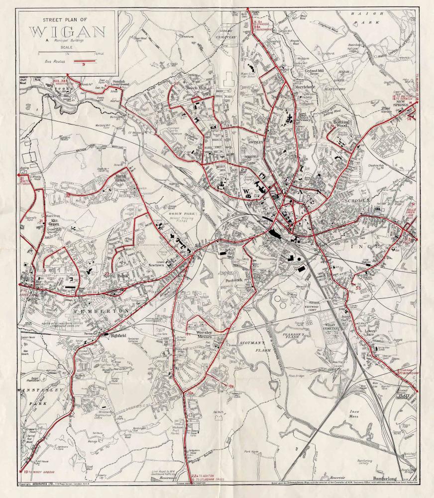
Wigan Album
Bus Routes
8 Comments
Photo: Dave Houghton
Item #: 11353
Fantastic map! The definition on my screen is not brilliant but is there a date on the map? I find it rather difficult to date. Balcarres Avenue and Balneil Walk, Whelley are on, they where completed 1964, but Scholes appears not to have been redeveloped. When was Scholes redeveloped? In addition the bus number for New Springs is simply 14. From memory, in the early 60's, the 14A used to turn up Cale Lane and terminate before the canal bridge. Another New Springs bus 14 or 14B used to terminate in Chapel Street, next to New Springs Independent Methodists Chapel. Does anyone know the year the service was changed to a simple 14?
Keith, Howden Drive, built 1967-68 and Mervyn Place, built 1968-69 are both on the map to the SW of Scotsmans Flash. The line to Wigan Central is still in place as far as Darlington Street, the station closed 1966/67. Pemberton loop line is still in place but the bridge over Poolstock Lane was demolished in 1971. I would therefore estimate the date of the map at about 1970.
Keith and Kevin, sorry about the definition. The map measures 15x18 inches and the scan has suffered in quality when uploaded. No date on the map. It was obtained from the Transport Office, Market Place, Wigan, between 1963/70.The job moved me to Leigh in 1970. If you need a better quality copy please email.
Bus Routes Can any one tell me when a bus left Wigan town centre got to its destination without passing a pub[I can]
Service Numbers Ran From 1-25 Not Counting Pit Buses Which One Did They Not Use I Do
was it 13 I know they used 13a and 13b
It Was Number 6 Albert Number 5 Was Standish And Number 7 Was Abbey Lakes Did You Work On The Ribble In The 1960's
Sorry Joe no I served time on Railways then onto Leyland Motors in 1949 till 1966,