Wigan Album
Mining
4 Comments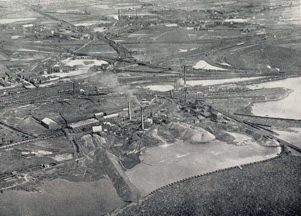
Photo: Ron Hunt
Item #: 19048
It is Moss Pits looking from the Westwood direction.The West Coast main line runs from left to right and the line from Springs Branch Junction towards Ince Moss can be seen running behind the pits.To the upper right Bamfurlong Sidings can be seen with lines from Ince Moss Junction to Bamfurlong Junction and over the WCML and on to the Whelley line
Ince Moss. Photo taken around 1936. No.6 pit roughly central, with Nos. 4 and 3 to the right. (Originally 6 pits were on this site).
The continuation of Cemetery Road into the pits complex is on the left. The West Coast Main Line comes in on the left about half-way up, and heads off south about two-thirds up on the right. The most complete street visible on the left is Hope Street - which joins Warrington Road - which heads off right to meet Taylors Lane - which crosses the line to Bickershaw and Manchester, and the WCML, before turning to cross under the line to St Helens. The very distinct line near the centre is the line to Bickershaw, and it is intersected by the Whelley Loop Line, which is the almost straight line across from left to right in the upper quadrant of the picture. Warrington Road meanders across from the left to the upper right.
re the photo I am trying collecting info on Pit Locos (especially locos from Low Hall etc)in 50s the photo shows Ince Moss etc but can anyone confirm the Colliery in middle at top of photo is LOW HALL?