Wigan Album
Lymm St./Boundary St. area.
7 Comments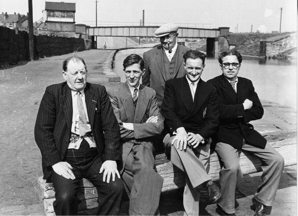
Photo: Allan Greenwood
Item #: 8715
Locals sat on the lock gates outside the Navigation public house. Britannia Bridge, Lower Ince
That's the first pic I've seen showing the bridge across the canal from Lower Ince to Central Station. Note 'Ince Pier' on the right - where coal was tippled into barges. Keep them coming!
I don't remember any coal being tipped into barges around there reverend. In front of the small wall on the right was what Calderbanks (the scrap people) occasionally used as extra storage. Behind the wall was railway property, which was why the wall was there. Further back behind that wall and across the line was the loco turntable, and again behind the wall and to the right was a water shed with a large iron tank on the top of it.
Allan
In Alan Godfrey's Old OS Maps series is a 1907 map of Wigan which shows the area in detail, including the turntable and water tower. There also exists a 1920s aerial pic of the Britannia Bridge area (I think it's copyright to the Museum, so can't put it up here), which also shows all that in detail - including showing Ainscough's yard when it was WESTWOOD MOTORS, where early motor cars were built under the Westwood name. The tippler is visible in this view. Things had changed by the 1950s....
What a wonderful photograph. It would be interesting if any of the group could be identified. I may be wrong but where we see the cyclist in the background, is that a colliery waste tip behind him, and if so could it have belonged to the Birkett Bank colliery of many many years ago? The colliery was situated on the open space that is now the home of St Patrick's Amateur Rugby League Club, Harper Street and Clarington Grove area I believe,or south of what is now Darlington Road East and the canal.
I knew three of the five people in the photograph. One was my father, my uncle, and his cousin (who is still alive).
The waste tip belonged to the colliery on the other side of the canal.
I know nothing of Birket bank colliery, I thought that the Birket Bank area was were Gullicks or Clarington forge used to be, at the top of Darligton Street east.
Thank you for that Alan. Yes I can see that the waste must have been from the other side of the canal (1907 map). I had a very short stint at Gullick's in the early 60's before going to college but Birkett Bank Colliery. "owned" by a certain Mr Lancaster occupied the area I mentioned but had closed perhaps over 50 years or more before this photo was taken. The colliery can be seen on the Old Maps site, there you can also see a Public House on the canal side at the bottom of Clarington Grove, again long since gone.
A parishioner has identified the man on the far right as his wife's brother-in-law, Teddy McDonald. He married Hattie Williams. She has died, but he lives in the multi-storey flats at Scholes.