Wigan Album
Boundary stones
5 Comments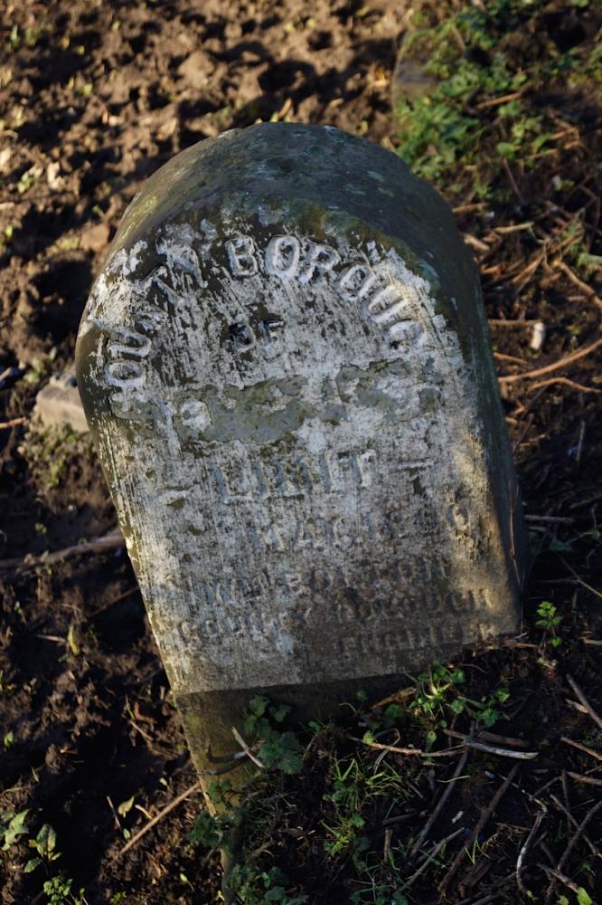
Photo: Rev David Long
Item #: 27338
The lettering says: COUNTY BOROUGH OF ----- -LIMIT- Then a date: MAY 18?0. As Wigan became a County Borough in 1889, that could be 1890.
Then: WM. BOLTON COUNTY BOROUGH ENGINEER.
William Bolton died in August 1924, aged 73. He was made the Engineer of Wigan Municipal Borough in 1876, when he was just 25 - so he was either very talented... or it was a minor post at that time.
I've not seen this stone before - and other boundary stones I've seen have been beside roads, usually showing the name of the neighbouring authority, and distances to Wigan centre etc.. Was Wigan ringed by stones such as this one?
Rev, The course of the main Wigan sewage pipe to Hoscar Moss is in this area , Could the Borough Engineer inscription refer to This ???
Could the word Wigan have been hidden during WW II precautions, similar to the removal of road signs?
Rev.David; Mick`s your man to answer your question. He will
have met quite a few!
Rev Ive just put the same photo of this stone taken a few years ago, on the forum section of Wiganworld
I thought it might have been dumped there when they where strengthening Martland Mill bridge
I don't access the Forums, Mick, so I hadn't found your pic, I'm afraid - though I did search to see if a similar image existed in the Album.
I think the stone is probably in its original position. I think that it was probably placed there to show where the boundary was after the previous, natural marker disappeared when the canal was built between Wigan and Liverpool a century earlier. Looking at the map, I think the boundary between Shevington/ Standish and Wigan Borough followed the line of the stream running down from the Giant's Hall area between the housing of Standish Lower Ground and Beech Hill. That would have run into the Douglas, presumably close to where this stone was erected - but was diverted when the canal was cut through.
A similar thing happened on the other side of Wigan, where the Clarington Brook formed the natural boundary between Wigan and Ince-in-Makerfield. The brook was diverted northward when the canal went through - but the boundary stayed where it was - marked by Boundary Street, and then running through the pub over the road (which operated under different Licensing regimes at each end), and then through the terraced row on the canal bank.