Wigan Album
Maps
7 Comments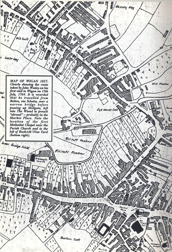
Photo: RON HUNT
Item #: 26879
Great map Ron. The Fishstones can be clearly seen (removed by 1866) and a better idea of just how the Old Moat Hall jutted out into the street - a complaint that was made after its construction.
Very interesting Ron
Apologies for the "typo" - it should read Moot Hall.
School Lane appears to end abruptly before it reaches what is now part of the town centre. The word "school" is written where it ends but I can't make out what is written beneath it. I wonder which school it was.
School Lane - almost certainly Wigan GS. See www.wigangrammarschool.co.uk. According to this website a Wigan Grammar School and accompanying land (School Common) was endowed in 1597 with money raised by the Mayor and a bequest from a London goldsmith. The school, which would have been very small, was behind the site of the present Little Theatre.
I think this map needs to be turned 45 degrees to the left to get the right orientation.
The "black rectangle" to the left of the Parish Church is I believe, the Commercial Hall - described in 1829 along with the Commercial hotel the Wigan Town Trail as " a commodious structure of brick, built in 1816, it was appropriated to the use of clothiers on fair days". In the 1851 Census, it continued, "amongst residents of Commercial Yard were 3 musicians and 9 strolling players - an area of considerable character."