Wigan Album
Views
15 Comments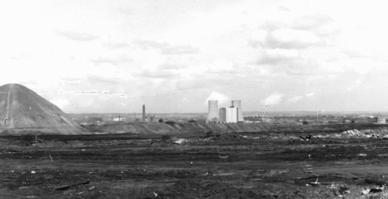
Photo: Brian Mc
Item #: 25439
Would that be the railway embankment of the Pemberton loop line.
yes the loop line is the nearest embankment going to right at a point just in front it diverts to the left to Wigan
Thanks for the photo Brian. We must always value what was. Your photo helps us remind us in this way.
Colin Harlow & Brian Mc
I don't think it is Pemberton Loop Line, because it does not look to be in the right position for it to be that loop line.
The loop line ran behind the slag heap. It may be the embankment emerging from the right of the heap in the picture?
Yes, this is the Pemberton Loop Line. It runs across the photo from left (behind the slag heap known as the Yo-Yo).
I think it's just possible to make out the bridge where the line crossed the B5238, Poolstock Lane near the Tippings pub. The bridge was dismantled in 1972.
I can't get my bearings round this one.
The line Did run next to the tall flats at Worsley Mesnes, and clearly, I can see a railway embankment.
Baldylocks, can you help?
not sure that's teloop line from that viewpoint loop line was at a much less pronounced elevation. circa 1961/3 there was a raised spoil heap with a flat top.think the loop line ran in slightly differently from good old worsley mesnes.ie that embankment ? is too high for the loop line ,which I believe is some distance away
THE loop line had a very high embankment, I think this is facing East.
Brian is this down foundry lane?
Did this line go over a bridge known locally as Skew Bridge?. I may be way off the mark.
the line did not go over Skew Bridge that is the line from Pem as photo shows it splits just after Pem station it crossed Warington Road near to Little lane to join at Ince park to Hindley, yes photo was taken Foundry Ln near to May Mil
Brian. Was Skew Bridge, the bridge near to Alexandra Park? If so, where did that line go to.?
yes Bridge near Alex Park line carried on to Hindley via Worsley Mesnes Lower Ince Amberswood joined joined L&Y there called an avoiding line mainly freight coal etc in later years
Thanks for the info, Brian.