Photos of Wigan
Photos of Wigan
Album Contents
Album Contents
Wigan Album
Mining
2 Comments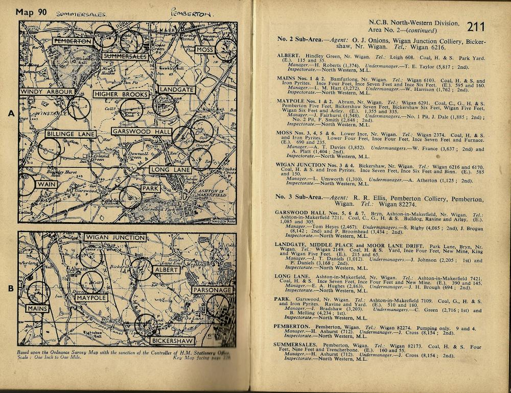
1949-Map of the Wigan (area2) Coal fields taken from "Guide to the Coalfields 1949" book.
Photo: Barrie
Photo: Barrie
Views: 2,489
Item #: 31338
Item #: 31338
Following on from the Standish page this is the Wigan coal fields. Note that Pemberton & Summerdale's may have been incorrectly titled and someone has corrected it above the map.
Comment by: Albert.S. on 13th July 2019 at 09:52
After working on the surface, and training for underground working, it was April,1950 before I went underground, at No.2, pit, Maypole. Jack Roberts, had taken over as under manager, by then. Johnny Dale was still under manager, at No.1 pit.
Comment by: priscus on 13th July 2019 at 17:56
Is it High brooks, or is it Higher Brooks?
Both names seem to be bandied around.
Or, is the place one name, and the mine tuther? (Seems unlikely, bu tha niva nose.)
Leave a comment?